Center for Geography Education
A Nexus for Geography Education Helps Oregon Teachers—and Their Students—See the World
Picture this: 20 fifth graders are running in the school gym, but instead of sneakered feet on glossy maple wood, they’re in bare and socked feet running on top of an enormous 14- by 21-foot durable fabric map. Beneath them is a representation of the State of Oregon, and as they move, they stop to compare what’s underfoot to various maps in their hands—of watersheds and water cycles, farm products, topography, precipitation, and indigenous tribal language groups, to name a few.
A teacher has asked them to draw their own mental map with as much information as they can recall about the physical and cultural features of the state. They’re comparing their mental map to the map they’re holding to the map they’re walking atop. All three became interwoven as they revise their mental map and compare their findings with friends, who have their own bevy of maps and ideas to share. Everyone is layering in new spatial conceptions to expand how they know the place where they live. As they laugh, stomp, and race, the idea of home becomes richer and more textured.
The Giant Map, smaller Student Atlas maps, and corresponding lesson plans come from the Center for Geography Education (C-GEO), an organization that offers geography tools, grants, and educational opportunities to K-12 teachers. C-GEO is led by Nancee Hunter of Portland State University and Kenneth Carano of Western Oregon University. Hunter is a geoscientist by training who came to this region following her fascinations with water resource issues. Carano is a social science teacher who served in the Peace Corps in Suriname and later became a teacher of teachers. Together, they each hold one side of the continuum that encompasses geography: on the one side, physical, life, and earth sciences; on the other, history, social science, and culture studies—“those connections with the human,” as Carano puts it. Geography is both the bridge between these and the interdisciplinary framework for seeing how they overlap and interplay to create our diverse and dynamic world.
As a teacher, there are many ways to engage with C-GEO. The organization offers the Giant Maps and maintains the Student Atlas, which comprises over 80 maps specific to Oregon and the Pacific Northwest. It offers curriculum and instructional materials written by and for Oregon teachers; organizes an annual geography education conference with 100-plus teachers; and provides grants for teachers to improve their geography class.
But perhaps the most full-circle encapsulation of what they do are the in-state and international institutes. Geography is an immersive field that comes alive in contact with real places and people. Throughout the year, C-GEO offers opportunities for teachers to come together in a specific place to learn about it deeply.
For a recent three-day institute, they partnered with the Confederated Tribes of Grand Ronde. Teachers took a behind-the-scenes tour of the powwow grounds, a local nursery, and their museum and then immersed themselves in a critical indigenous framework. Based on what they saw, who they met, and primary sources they referenced, they developed critical questions, a geographic analysis, and lessons plans. Grand Ronde educators vetted their work, which some will present at future C-GEO conferences and institutes.
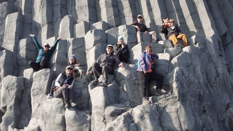
Each year, C-GEO take a group of teachers abroad and pays most of their expenses, including transportation and accommodations. Over the past ten years, they’ve brought teachers to Chile, Cuba, Greece, Iceland, Portugal, Quebec, Spain, and Vietnam for two-week whirlwind tours with local guides and multi-layered cultural experiences.
“Most teachers are overworked and not treated like professionals,” Carano relays. This very hands-on geography education asks a lot of participants, but the trips also show teachers regard and care.
C-GEO always strives to include teachers who’ve never travelled internationally, which Hunter calls “one of the most rewarding aspects of this job.” Carano remembers swimming in a rainstorm in Vietnam with a teacher who’d done very little traveling before. This too is a kind of tactile geography lesson: in this place, humid rain drips warmly from the summer sky. Like the in-state institutes, teachers who participate write geography curriculum to utilize and share.
“Human beings make maps, and we all come from a point of view,” Hunter says, erasing any notion that maps are unbiased or singularly authoritative. But the human lens is what makes geography such a powerful educational framework. Learning about other’s points of view within broader dynamic contexts can undermine stereotypes and build curiosity and empathy. Geography teaches spatial thinking. No other discipline does it the same.
Carano can’t resist the dad joke: “Without geography, you’re nowhere.” And these teachers swimming in Vietnam’s warm rains and students running across and within Oregon’s maps are definitely somewhere.